
SMO Land Areas Now Available for Public Parks and Community Spaces
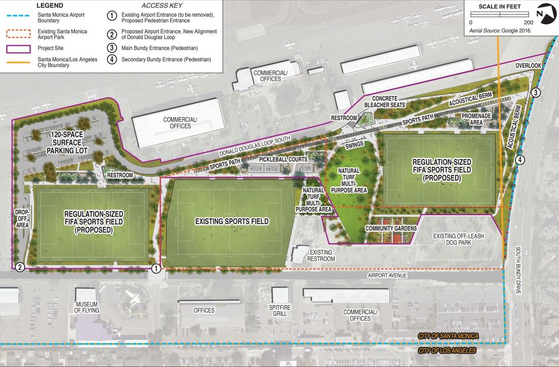
Phase 1: Expanded Airport Park (in progress)
Source: Airport Park Expansion EIR
Source: Airport Park Expansion EIR
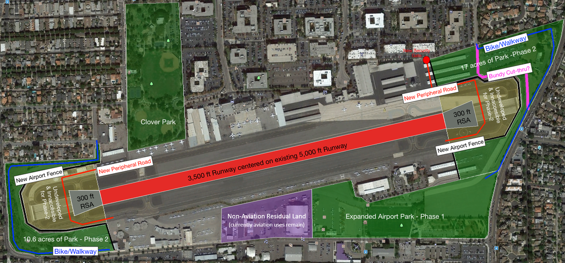
Phase 2: Runway Ends (green shaded areas at runway ends) + Western Portion of Non-Aviation Residual Land (purple shaded area)

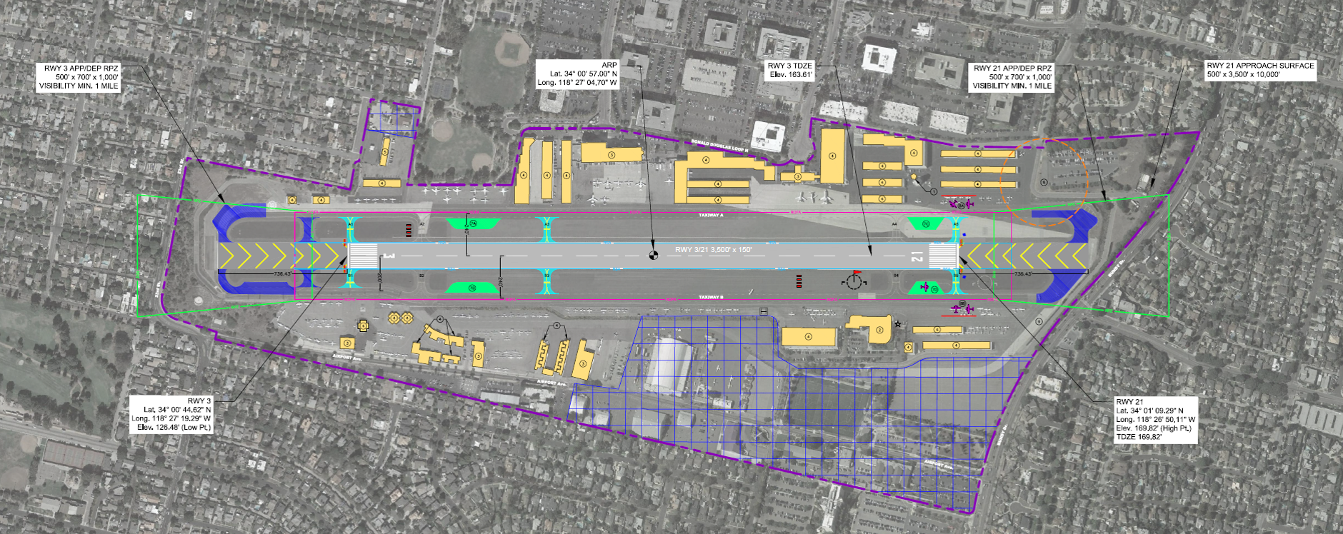
1984 Agreement Airport Layout Plan: SMO Non-Aviation Residual Land
Sources: (a) 1984 ALP copies; (b) 1984 Agreement - Sections 5 and 6; (c) 1983 SMO EIR; (d) Page in 1983 SMO EIR; (e) 1983 SMO Master Plan
Sources: (a) 1984 ALP copies; (b) 1984 Agreement - Sections 5 and 6; (c) 1983 SMO EIR; (d) Page in 1983 SMO EIR; (e) 1983 SMO Master Plan
2017 Airport Diagram: SMO Non-Aviation Residual Land is incorrectly marked and should extend further on the western side Source: 2017 FAA Letter and Airport Diagram
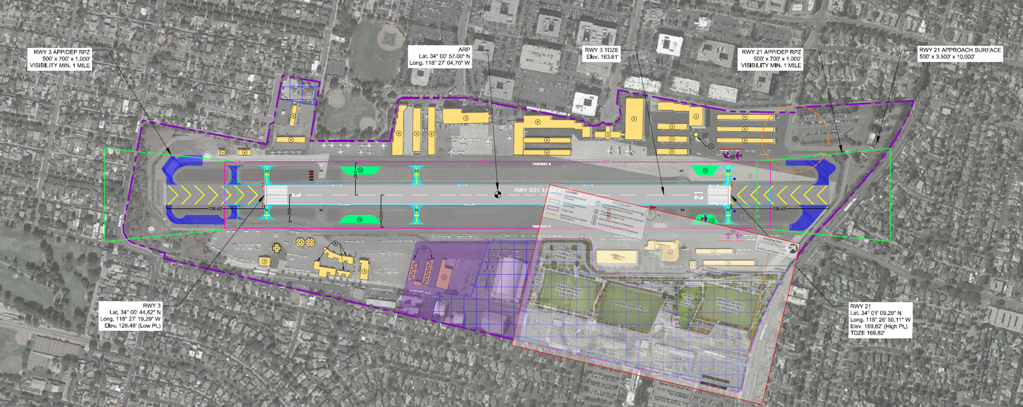
The Expanded Airport Park and the Western Portion of the Non-Aviation Residual Land Overlayed on the 2017 Airport Diagram
